A machine learning approach for spatial mapping of groundwater contamination and its application of public health management

Groundwater contamination has an adverse impact on the health, making this an issue of critical environmental and public health concerns. Conventional method for spatial mapping of groundwater contamination based on linear geostatistical theory can have high uncertainty at non-sampled locations due to the heterogeneities of subsurface and the nonlinearity of the contaminant transport process. This study apply the ANN to spatially map groundwater arsenic contamination in the Lanyang Plain. Mapping the spatial distribution of groundwater contamination with higher accuracy can be used to describe the areas that residents are at high risk due to the ingestion of As containing groundwater, prioritize the areas where more intensive monitoring of unsafe groundwater quality is required.Spatial mapping using ANN approach have the flexibility to deal with high uncertainty at non-sampled locations by updating the weight factors based in supervised learning and using the nonlinear activation function in each neural node and the layered structure comprised of several neural nodes. This study applies the ANN to spatially map groundwater arsenic contamination in the Lanyang Plain. The superiority of ANN approach is confirmed by its higher probability of successful detection. A sound human health management plan for ingestion of groundwater in the Langyang Plain can then be developed base on spatial map of health risk to help government administrators to develop measures to protect groundwater resource.Prioritizing the areas where more intensive monitoring of unsafe groundwater quality can reduce the cost and time required for establishment of monitoring wells as well as sampling and laboratory analysis of groundwater quality. The superior performance of ANN-based spatial mapping of groundwater contamination demonstrates that the technology developed in this study can be further developed as an efficient tool for executing groundwater monitoring network planning by environmental engineers in consulting firms or developing the human health protection plan by public health personnel in the government sectors.
Smart learning language spelling software/The application of English vocabulary learning with smart phones and computers
Video-based blood pressure and respiration measurement and its applications in the home sleep apnea and health management system

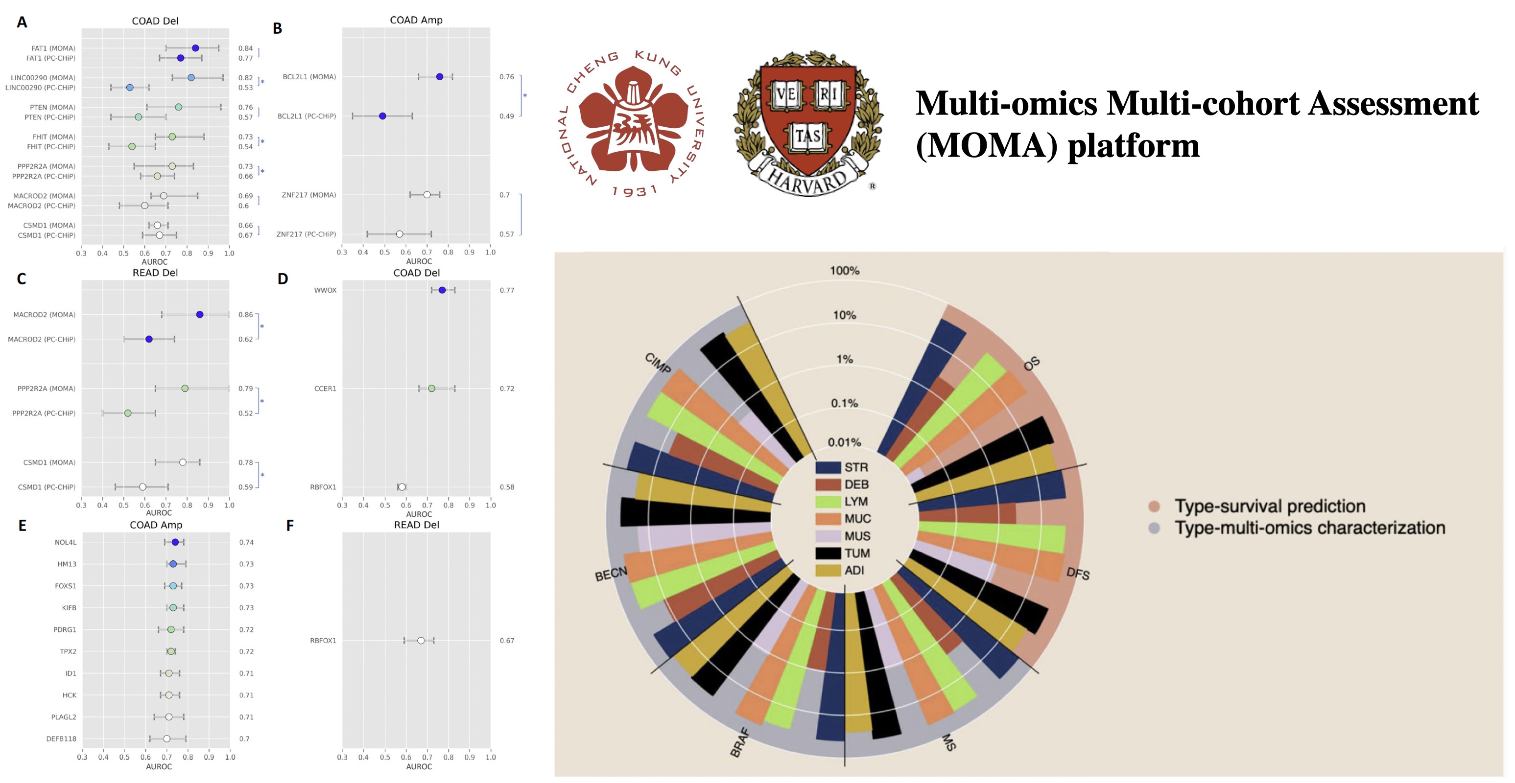
A Pioneer Novel Weakly-supervised Multi-instance Learning Framework for Genetic Expression Recognition and Survival Prediction in Digital Pathology Images

"1) Integrating AI recognition, IoT, and blockchain into traceable software and hardware for recycling UCO 2) Cutting-edge 3D learning platform powered by Spatial AI 3) Optimize use of existing buildings by making them transformable and adaptive to human needs at the click of a button 4) Non-contact image analysis and calculation technology to capture vital signs through dynamic face detection"
Technology maturity:Concept
Exhibiting purpose:Technology transactions、Product promotion、Display of scientific results
Trading preferences:Technical license/cooperation
Coming soon!