Visual-Guidance Navigation System and Methods usingReal-Time Visual Anchor Detection
.jpg)
Information of interests identified from mobile videos such as the status of a traffic light is useless without an accurate geo-location. OmniEyes localization techniques use only one monocular camera to provide up to 1 meter geo-resolution. The best thing is --- it can be seamlessly integrated into our edge models.
OmniEyes開發一個新的生態系統,賦予行車紀錄器影像再利用價值,透過人工智慧分析即時街景和駕駛人違規行為,用於商業車隊可降低管理成本,此外,將車隊蒐集之街頭影像,以雲端互連共享平台的方式建置,打造第三方服務與應用。

Visual-Guidance Navigation System and Methods usingReal-Time Visual Anchor Detection
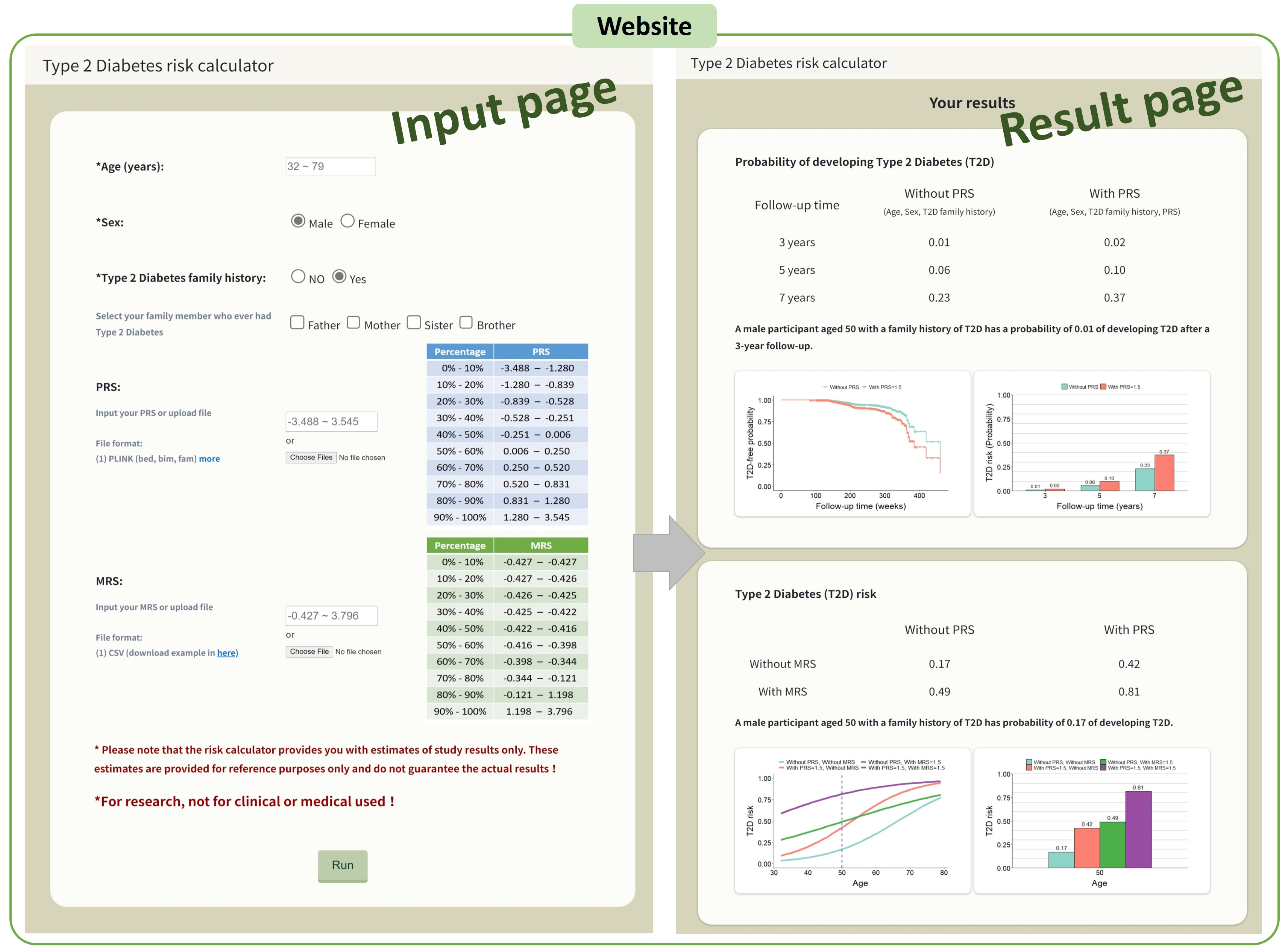
AI-Enhanced Integration of Genetic and Medical Imaging Data for Risk Assessment and Precision Health of Type 2 Diabetes
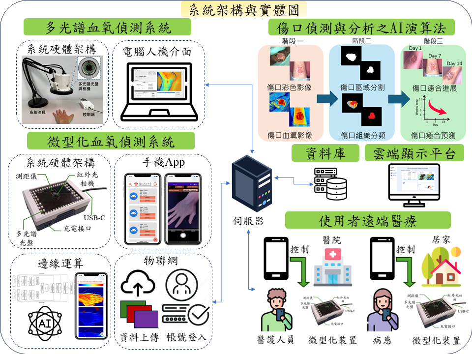
A multispectral light source based miniaturized tissue oxygenation imaging system for telemedicine wound healing phases recognition
"1) Integrating AI recognition, IoT, and blockchain into traceable software and hardware for recycling UCO 2) Cutting-edge 3D learning platform powered by Spatial AI 3) Optimize use of existing buildings by making them transformable and adaptive to human needs at the click of a button 4) Non-contact image analysis and calculation technology to capture vital signs through dynamic face detection"
Technology maturity:Mass production
Exhibiting purpose:Product promotion
Trading preferences:Technical license/cooperation
*Organization
*Name
*Phone
*Main Purpose
*Discuss Further
*Job Category
*Overall Rating
*Favorite Area
*Key Tech Focus
*Willing to Receive Updates?
Other Suggestions
Coming soon!