The Application of Integrated Ground-based and Airborne LiDAR in Slope Disaster Investigation
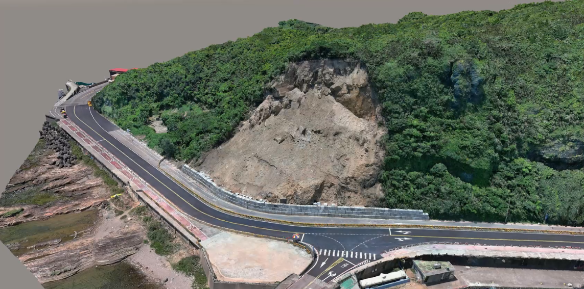
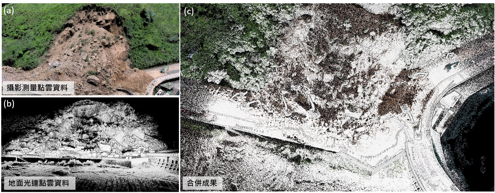
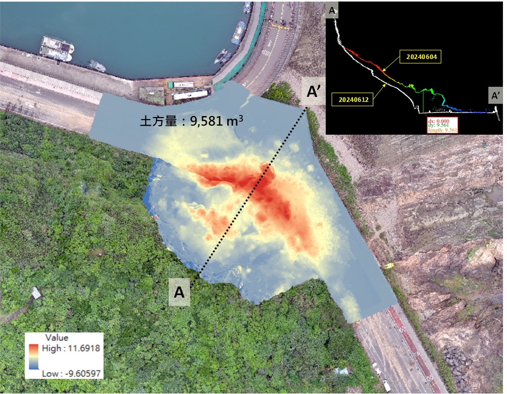


Using LiDAR technology, high-density point clouds are generated to produce high-precision 3D images. This technology is particularly valuable in slope disaster investigations, where it can quickly capture detailed features of steep and unstable terrain. By integrating drone-LiDAR with handheld ground-based LiDAR, the system make it an essential tool for slope disaster investigations, enabling the collection of large-scale, high-density point cloud data for detailed terrain analysis.
As the technology advisory staff to the Central Disasters Prevention and Protection Commission, Executive Yuan, NCDR coordinates and collaborates with government sectors for planning, organizing and promoting technology innovation, providing a platform of information service and technology integration, and designing the policies of disaster prevention. In accordance with the Act for the Establishment of the NCDR, NCDR’s primary missions are: ·Promote and conduct activities related to applied research and development on disaster management. ·Facilitate scientific knowledge and technological advantages for practical implementations to benefit the whole society. ·Apply outputs of science and technology to disaster risk reduction and emergency preparedness. ·Build up international partnerships to exchange experiences and conduct joint projects. ·Collaborate with domestic research institutes to engage stakeholders’contributions for reducing disaster risk and enhancing emergency preparedness. ·Provide relevant services related to disaster management.
The verification mechanism of power generation using the Weather Research and Forecasting Model (WRF) and the Power Generation Geographic Information System in T-REC
A New Hardware-security Technique for 5G-AIOT Applications: A Low-cost, Low-power, and High-speed “Dielectric-fuse Breakdown OTP” (dFuse OTP) Fully Integrated on CMOS Platform without Additional Masks
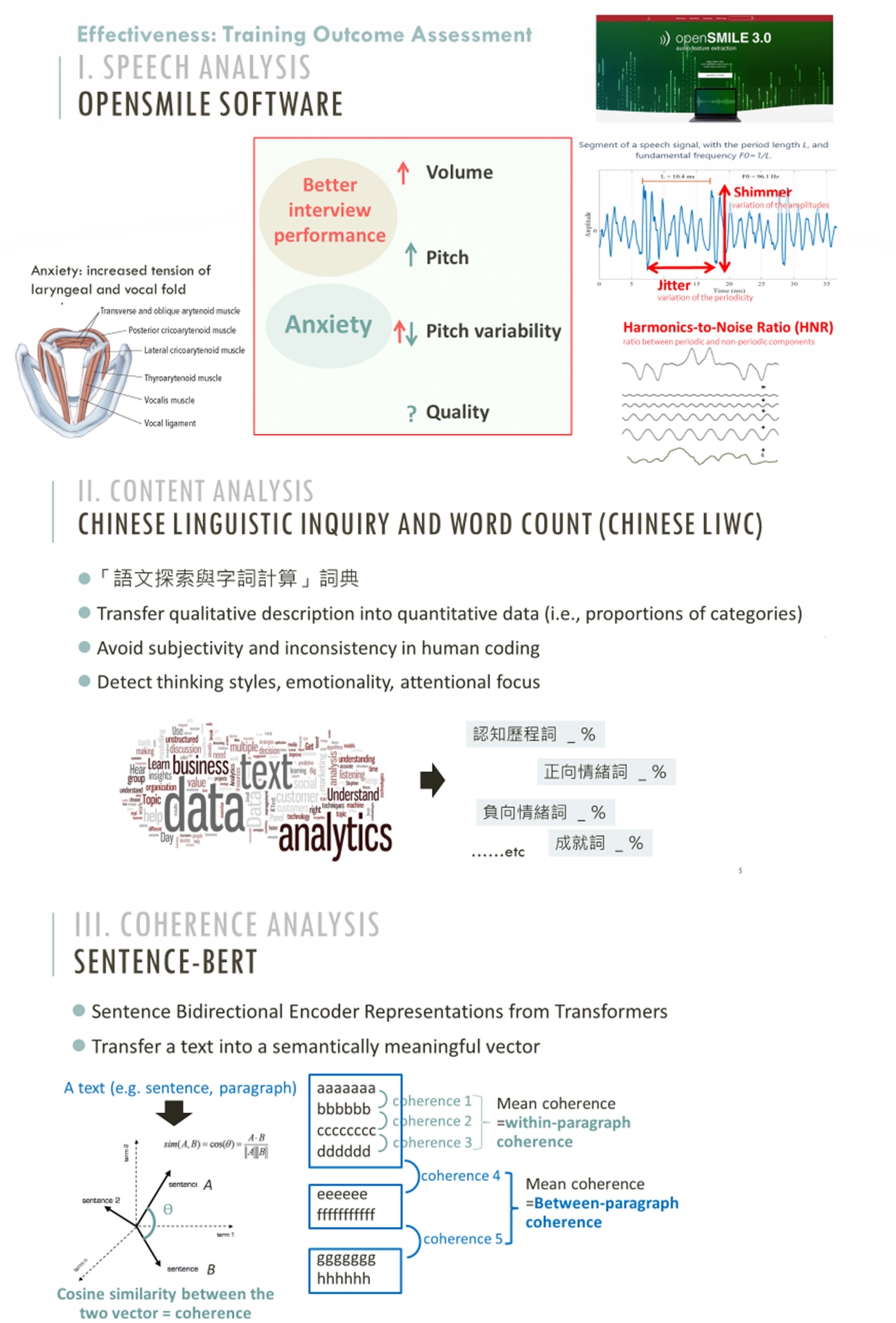
Targeting job interview and workplace communication skills for autistic adults: An innovative cognitive-behavior therapy-based virtual reality intervention program
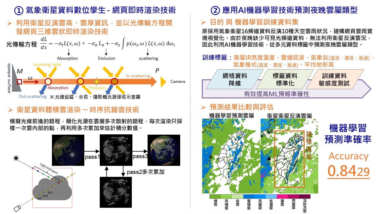
The Application of AI Technology in Disaster Prevention Demonstration
Technology maturity:Experiment stage
Exhibiting purpose:Display of scientific results
Trading preferences:Negotiate by self
*Organization
*Name
*Phone
*Main Purpose
*Discuss Further
*Job Category
*Overall Rating
*Favorite Area
*Key Tech Focus
*Willing to Receive Updates?
Other Suggestions
Coming soon!